Wednesday, July 26, 2006
Whaling Wall #53 (South Padre Island)
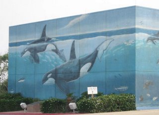
Gracing the walls of the South Padre Island Convention Centre is a huge mural done by the artist Wyland. To increase public awareness for all sea life (not just whales), he made it his goal to complete 100 such Whaling Walls throughout the world by the year 2011; currently, he's on number 84. His first mural was completed in 1981 at Laguna Beach, California. After much persistence, the city of South Padre Island convinced him to paint a Whaling Wall in their town, which he did in March 1994. He has murals all over the United States, as well as in Mexico, Canada, France, Japan, Australia, and New Zealand.
Links:
Sunday, July 23, 2006
City of South Padre Island
Padre Island used to be a continuous 113-mile (182 km) stretch of barrier island. In 1962, with the completion of the Mansfield Channel, a North and a South Padre Island were formed.
South Padre Island is approximately 34 miles (55 km) long, bounded by Brazos Santiago Pass to the south and the Mansfield Channel to the north. On the other side of the Mansfield Channel is North Padre Island and the beginning of Padre Island National Seashore. Padre Island National Seashore runs for about 66 miles (106 km), and the remaining 13-or-less miles (21 km) of Padre Island takes you towards Corpus Christi.
South Padre Island has a city of the same name located at its southernmost tip. The city of South Padre Island is hugely popular with the spring break crowd. I didn't know quite what to expect when I visited, but I was expecting it to be bigger. The town proper is only about 5 miles (8 km) long and about 1/2 mile (.8 km) at the widest point.
The layout is nice and simple. Padre Boulevard (Park Road 100) is the main drag through the center of town. Turn towards the Gulf of Mexico and you hit Gulf Boulevard. Turn towards Laguna Madre and you hit Laguna Boulevard. Both Laguna Boulevard and Gulf Boulevard have numerous access points to their respective bodies of water.
On the south side of the city is the popular Isla Blanca Park and the relatively new Schlitterbahn Beach Waterpark, which opened in 2001. On the north side of town is Andy Bowie Park, the convention centre with its Whaling Wall, and a scenic boardwalk. While traveling the length of the town, you'll pass restaurants, clubs, beach supply stores, hotels, and various other accommodations.
We visited during the off-season (mid-May), so traffic was minimal and getting around was easy. What it's like when the crowds arrive, I can only imagine.
Links:
Thursday, July 13, 2006
Queen Isabel Inn (Port Isabel)
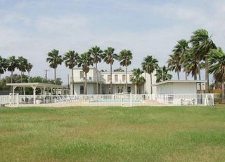
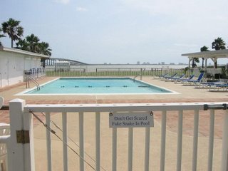
One place we stayed during our visit to south Texas was the Queen Isabel Inn, a Texas historic landmark. Our room was comfortable with plenty of amenities. It had a DVD player, and you could borrow DVDs from the Inn's collection. The bathroom was stocked with almost every item you could have possibly forgotten from home. The full kitchen also had everything you needed, except for food, which could be found at the huge HEB in town. Eating breakfast at the room saved us time and money. The most surprising thing to me was that this 100-year-old Inn had wireless internet access; this was definitely a plus.
The atmosphere of the place was laid back, and the owner John Haywood was very friendly. Originally from Brownsville, he purchased the Inn in 1978. As you would guess, he's very knowledgeable of the area. He seemed to enjoy talking to guests, and seemed very concerned whether we were having a good time (we were).
When the Queen Isabel Inn opened in 1906 it was called the Point Isabel Tarpon and Fishing Club. It was located adjacent to a Rio Grande Railroad depot. The Rio Grande was a 22.5 mile (36.2 km) track that opened in 1872 and connected Point Isabel to Brownsville. (Note: The depot is no longer there, but the city does have plans on building a Rio Grande Railroad Park, which would include a pavilion modeled after the original depot.)
The Inn was the beginning of the hotel and tourism industry that would later define the area. Recently, the Queen Isabel Inn received the Texas Treasure Business Award from the Texas Historical Commission for its active community involvement over the last 100 years.
Links:
- One of the most famous visitors to the Inn was President-elect Warren G. Harding. In November 1920, before his inauguration, Harding visited Republican party leader Rene Creager at his home in Brownsville. Later, Harding went fishing around Point Isabel. See photo of Harding fishing at Brazos Santiago.
Tuesday, July 04, 2006
Another Lighthouse View (Port Isabel)
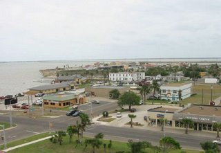
We're standing atop the Port Isabel Lighthouse looking out in a southeastern direction. South Padre Island is on the horizon and the body of water in view is the Laguna Madre. The white building in the center of the photo (closest to the water), is the Queen Isabel Inn, which was built in 1906.
If you wanted to take a ship and head out to the Gulf of Mexico, you would go in this general direction. At the far southern tip of South Padre Island is an opening called Brazos Santiago Pass, which would take you to the Gulf. While making your way through the pass, you would have South Padre Island to your left, and on your right would be Brazos Island. On Brazos Island was located Brazos Santiago.
In 1850, the U.S. Congress appropriated 15,000 dollars to go towards a lighthouse and beacon for the port at Brazos Santiago. Local authorities agreed that the lighthouse should be placed at Port Isabel and the beacon should be placed at the southern tip of South Padre Island.
The beacon, as it turned out, was a light mounted on a wooden structure, and the wooden structure rested on wheels. It went into service in August 1852, and in less than a year's time there were already complaints, one of which was that it burned too much oil. Around 1855, a new wooden structure was built and a new light was installed.
During the Civil War, the beacon's light was turned off, as was the case for all Texas lighthouses at this time. After the war, the light returned, but it shone from Brazos Island instead of South Padre Island. A temporary wooden structure three stories tall was placed there, and it was put into operation on August 24, 1864. This temporary structure was used for almost a decade until a hurricane blew it away in September of 1874. This storm also took the life of the lighthouse keeper's wife.
Another temporary light was set up to replace the former temporary light.
The Lighthouse Board thought it was time for a permanent lighthouse and suggested an iron lighthouse of the screw-pile variety that would be placed in a shallow section of water at the southern end of South Padre Island. Congress gave the go-ahead, and the new Brazos Santiago Lighthouse went into service on March 1, 1879. This lighthouse stayed in operation for sixty-one years. It was destroyed by fire on March 7, 1940. Shortly afterwards, a new beacon was placed on a nearby Coast Guard station.
Books:
Baker, T. Lindsay, Lighthouses of Texas, College Station: Texas A&M University Press, 2001
Links:
- Check out the great photo of Brazos Santiago Pass that was taken using kite aerial photograpy! For more photos of the South Texas coast, check out the main site here.
Subscribe to:
Posts (Atom)